Portland Then and Now: The Downtown Waterfront
In 1928 the west bank of the Willamette was a construction pit. Stand on the Hawthorne Bridge today and compare notes with the old photograph.
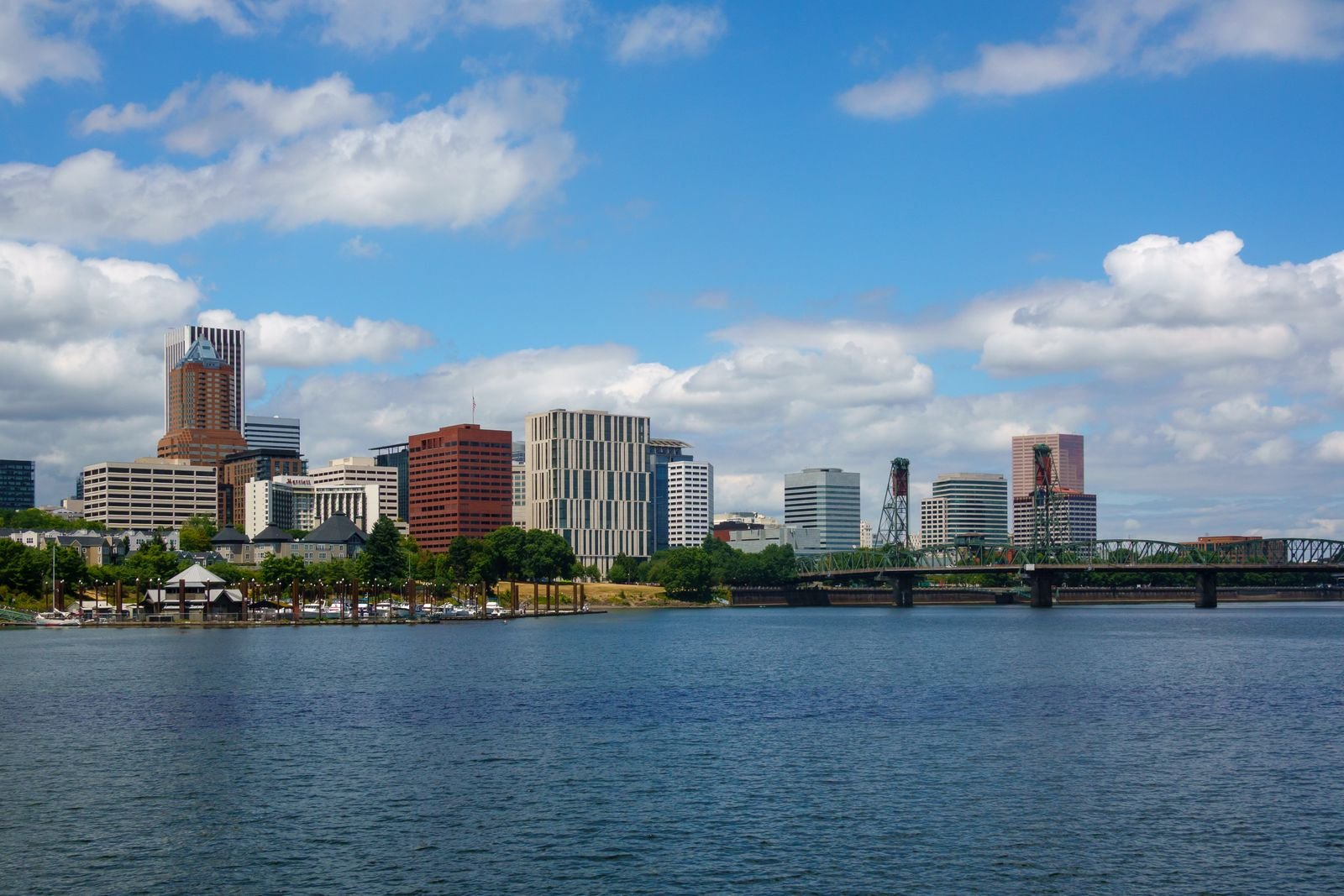
 Then
Now
Drag the handle to compare Then and Now.
Stand at the west end of the Hawthorne Bridge, lean on the railing, and look north. Joggers, a long lawn, a row of trees, the river sliding past a tidy concrete edge. It looks like it has always been this way, which is the trick every good piece of infrastructure plays.
A photograph taken from almost this exact spot in 1928 shows something else entirely: a muddy trench full of timber, cranes, and men building a wall between the city and its river. That wall is still there. You are more or less standing above the south end of it.
Before the wall: a working riverfront gone to seed
Portland began at the water. In the nineteenth century the west bank of the Willamette was a continuous line of wharves, warehouses, and docks, most of them built on pilings and stacked two or three levels high so that ships could load whether the river was up or down. Front Street was where the money was made.
By the 1920s that had changed. Shipping had been moving downstream to bigger, more modern terminals for years, and the old central waterfront was left with sagging docks, empty warehouses, and a smell. A city that liked to think of itself as respectable had a rotting wooden fringe along its front door.
There was also the matter of the river itself. The Willamette floods. It does so on its own schedule and without consulting anyone. In June 1894 it rose high enough that people rowed boats through the downtown streets, and smaller floods came often enough that basements near the river were a gamble. On top of that, the sewers in the low part of downtown emptied straight into the Willamette, and when the river came up, the sewers backed up with it.
Olaf Laurgaard’s answer
The fix was the work of city engineer Olaf Laurgaard, who designed a harbor wall to run along the west bank through the heart of downtown. His plan did three jobs at once:
- Flood protection. A solid concrete wall, tall enough to keep ordinary high water out of the business district.
- New land. Clearing the wharves and filling behind the wall gave a crowded downtown a strip of usable ground and room to widen Front Avenue.
- A sewer interceptor. A large pipe built in behind the wall collected the outfalls that used to dump into the river along the waterfront, which ended the chronic backups in a large part of downtown.
The J.F. Shea Company built it, and the 1928 photograph catches them in the middle of the job. The wall was finished in 1929. The old dock buildings came down, Front Avenue was widened, and for the first time Portland had a clean, hard edge where the city met the Willamette.
What it did not have was much idea of what to do with that edge.
The detour: a freeway on the river
For a few years the cleared waterfront held odds and ends, including a very large public market building that opened in the 1930s near the Hawthorne Bridge and never quite paid its way. Then the automobile arrived with an answer nobody would give today.
In the early 1940s the city built Harbor Drive, a multi-lane expressway running the length of the downtown riverbank. For three decades, the view from this railing was traffic. You could see the Willamette from downtown, but getting to it on foot meant crossing a highway, and hardly anyone bothered.
By the late 1960s, with Interstate 5 open on the east bank and the Fremont Bridge and Interstate 405 on the way, Harbor Drive was looking redundant. Governor Tom McCall pushed a task force to study removing it, citizens lobbied loudly for a park, and in 1974 the road was closed. Portland became one of the first American cities to tear out a freeway and not replace it with another one.
The park opened in 1978. In 1984 it was renamed Tom McCall Waterfront Park, which seems fair.
What you see now
The modern photograph from the Hawthorne Bridge shows the same wall doing the same job, with a very different city behind it. A walk north from the bridge takes in most of what has been layered on since:
- The Bowl, the sloping lawn just north of the bridge, where the blues festival crowds sit in July.
- Salmon Street Springs, the fountain at the foot of SW Salmon, added in 1988 and occupied by children from the first warm day of the year.
- The Battleship Oregon mast, standing near SW Oak as a memorial to the ship.
- The Japanese American Historical Plaza, at the north end near the Steel Bridge, with its row of cherry trees that draw half the city for about ten days each spring.
All the way along, the promenade at the river’s edge runs on top of Laurgaard’s wall. The railings and paving are newer. The concrete under them will soon be a hundred years old.
Then and now, honestly compared
It would be neat to say the harbor wall gave Portland its waterfront. It did not, quite. It gave Portland a dry downtown and a blank strip of land, and the city then spent forty years using that land badly before getting it right.
The wall also did not make the river clean. The interceptor moved the sewage problem rather than solving it, and it took the Big Pipe tunnels, finished in 2011, to stop most combined sewer overflows into the Willamette. People swim off the downtown docks now. In 1928 that would have been considered a medical event.
Still, everything you enjoy along the west bank sits on that 1929 decision. Slide between the two photographs and the piece that does not move is the wall.
How to do this walk
Start on the Hawthorne Bridge’s north sidewalk at the west end for the photo comparison. Take the stairs or the ramp down into the park, follow the promenade north to the Steel Bridge, cross on the lower deck walkway, and come back along the Eastbank Esplanade. From the east side you finally get to see the face of the wall you have been walking on. The loop is a little under three miles and almost perfectly flat, which in this town is worth mentioning.
- portland
- waterfront
- willamette river
- harbor wall
- tom mccall waterfront park
- then and now