Portland in Pictures: St. Johns Bridge and Cathedral Park
Portland's only suspension bridge sits miles downstream from downtown, which is why so few people see it properly. The best view is from the grass underneath.
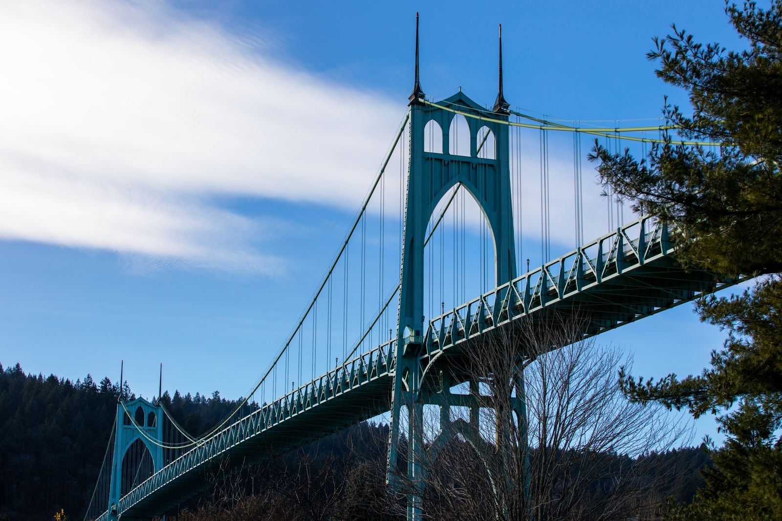
Stand on the grass at the bottom of N Pittsburg Avenue and look straight up. A row of concrete arches, each one pointed at the top like a church window, marches away from you toward the river, and far above them a green steel deck carries trucks you can hear but not see. This is the underside of a highway bridge. It is also one of the best looking rooms in Portland, and it has no walls.
Most cities hide the space under a bridge behind a chain link fence and a few shopping carts. St. Johns got a park.
The bridge nobody downtown thinks about
The St. Johns Bridge is a few miles downstream from the central city, well past the last of the drawbridges, and that distance is the reason plenty of Portlanders have never stood next to it. They know it from postcards and from the window of a car on Highway 30.
It is the only suspension bridge in the city, and I will say plainly that it is the most beautiful bridge we have. The Fremont is bigger and the Steel is stranger, but nothing else on the Willamette has this combination: two tall towers with Gothic openings, long sweeping cables, and the dark fir wall of Forest Park rising directly behind the west end. On a gray morning the green steel nearly disappears into the hillside. On a clear evening it glows.
A few plain facts
- Opened: June 1931, after about two years of construction
- Type: Steel suspension bridge, the only one in Portland
- Designers: Robinson and Steinman of New York
- Towers: Around 400 feet tall, the tallest bridge towers in the city
- Connects: The St. Johns neighborhood on the east bank with Linnton and the industrial west bank below Forest Park
- Owner: The state of Oregon, as part of the highway system
How it got built
Before 1931 the way across the river here was a ferry. St. Johns had been its own city until Portland annexed it in 1915, and its residents had wanted a bridge for years. The west bank was filling with industry, the ferry was slow, and the nearest fixed crossing was a long way upstream.
Not everyone agreed. A big bridge this far from downtown looked to some voters like an expensive favor to a remote corner of the county. The supporters won the argument at the ballot box, and the work began just as the Depression arrived, which turned a controversial project into a welcome source of jobs.
The design came from David Steinman and his partner Holton Robinson. Steinman was one of the great American suspension bridge engineers of the century, and later the man behind the Mackinac Bridge. He was also an engineer who cared a great deal about how a bridge looked, which was not a universal trait in his profession. For St. Johns he gave the steel towers tall pointed arches and carried the same Gothic shape down into the concrete piers of the approaches. He is often quoted as calling it his favorite of all his bridges, and looking at it, I believe him.
The color was a fight too. The story usually told is that officials worried about aircraft from the airfield then operating on Swan Island and wanted the towers painted in high visibility stripes. Steinman’s side held out for green, to sit quietly against the forest. Every time I look at it I am grateful that somebody in the 1930s lost that argument. Portland does not always get these decisions right, as I have complained at length in Five of Portland’s Biggest Mistakes, so it is pleasant to record one that went well.
Cathedral Park
The park takes its name from those approach piers. From ground level on the east bank they line up into a series of monumental archways, tall and narrow, one inside the next. The seed of the name is obvious the moment you stand at one end and look through.
For decades the land down here was the sort of leftover riverfront you would expect, weedy and used for dumping. Neighbors in St. Johns pushed through the 1970s to have it cleaned up and made into a proper park, and the city finally dedicated it around 1980. That is the reverse of the usual Portland sequence, in which we demolish a thing and then hold a memorial for it.
What you get today:
- Wide slopes of grass running from the neighborhood down to the water
- Paved paths that pass directly beneath the arches
- A small stage area, home to a free jazz festival each summer
- A boat ramp and a floating walkway out on the river
- A memorial recognizing the Chinook peoples who lived along this stretch of the Willamette long before any of the rest of it
It is a surprisingly good place to spend a day under a bridge. That is a sentence I did not expect to write about any city.
The photo walk
Through the arches
Start at the upper end of the park, near N Edison Street, and walk the center line beneath the deck. This is the cathedral shot: arch framed inside arch, shrinking toward the river. Early morning is quietest. A person standing at the base of a pier gives the picture its scale, because the piers nearest the water rise well over a hundred feet and the eye refuses to believe it without help.
The east anchorage
Up the slope, where the main cables come to ground, sits the enormous concrete block that holds them. Few people photograph it. I think it is the most honest part of the bridge. All that grace out over the water depends on a lump of concrete the size of an apartment building refusing to move.
The east tower from below
Walk down toward the river until the east tower is directly overhead. Tilt the camera up. The pointed openings stack one above another, the cables fan out to either side, and the spires at the top look like something borrowed from a much older building. A wide lens helps, and so does lying on your back, which nobody in this park will find odd.
Out on the floating walkway
The dock by the boat ramp puts you on the water itself. Turn around and you have the whole park behind you with the arches stepping up the hill. Turn back and you have the full span broadside, with the west tower standing against Forest Park. This is the classic view, green steel on darker green trees, and it is the one I come back for.
Up on the deck
If you want the other perspective, climb to N Philadelphia Avenue and walk out on the sidewalk. Be warned that it is narrow, the traffic is quick, and heavy trucks make the deck tremble. The reward is the river far below, downtown small in the distance upstream, and on a clear day a mountain or two on the horizon.
When to go and how to get there
Late afternoon puts warm light on the east tower and the arches. Fog is even better, if you can catch a morning when the towers vanish halfway up. Summer weekends are busy with picnics, dogs, and wedding photographers, all of whom have worked out the same thing you have.
From downtown it is about twenty minutes by car, and worth the drive. TriMet buses run out to the St. Johns town center, a few blocks uphill from the park, where you can also find coffee, lunch, and a main street that still feels like the separate small town it used to be.
It is no Golden Gate in size. But you cannot walk up and put your hand on the Golden Gate’s piers, and here you can, which makes this one feel larger than its numbers. Pack a picnic. Bridge geeks, and I count myself, should plan on staying longer than intended.
- portland
- st johns bridge
- cathedral park
- north portland
- willamette river
- bridges
- forest park
- david steinman